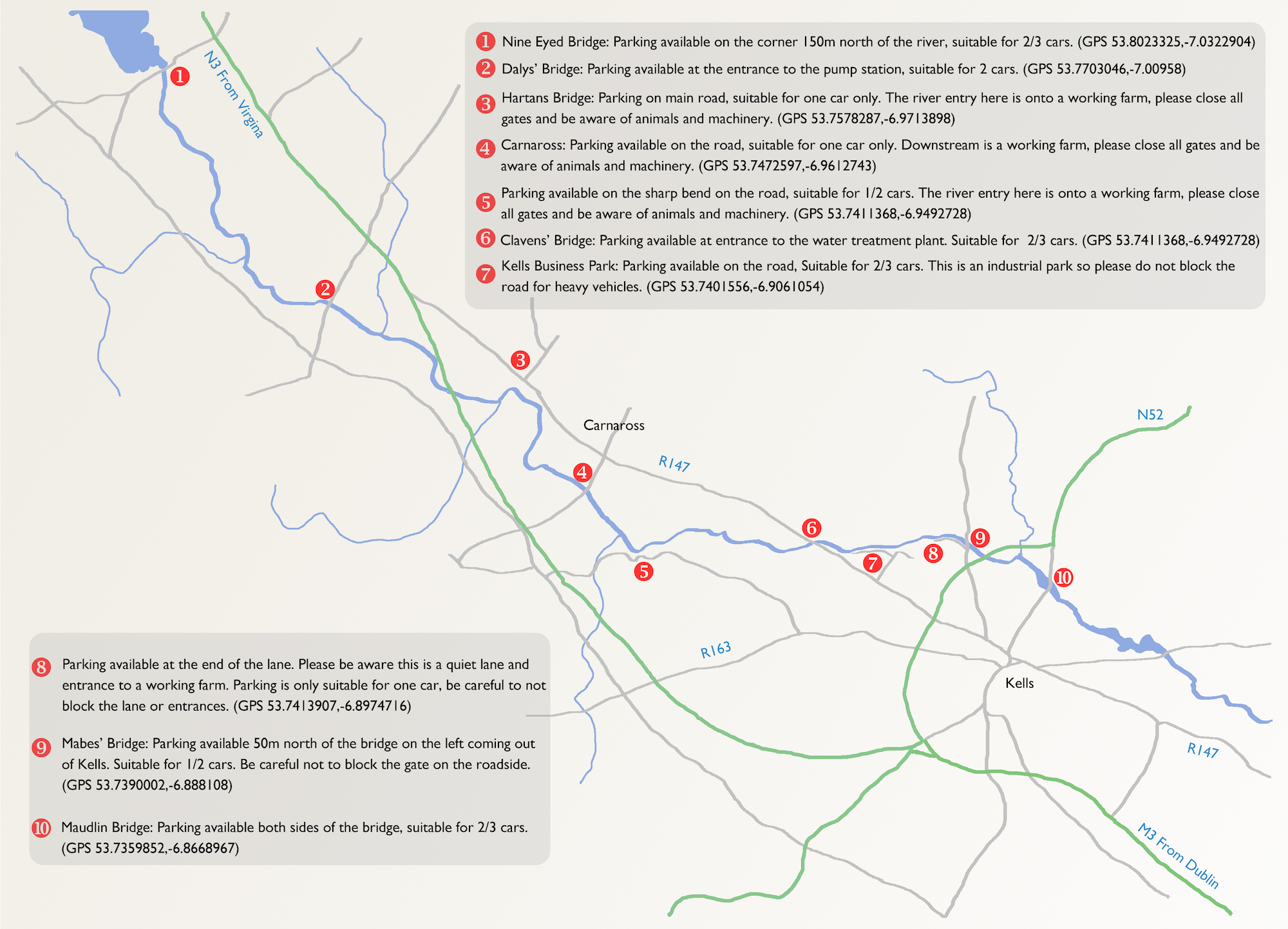
Kells Anglers preserve the river from Lough Ramor to Headford Bridge. Access and parking are available as shown on the map below. Please respect the lands surrounding the river, it is with the kind permission of the repairian owners that we are able to fish the river. Please leave the river and land as you have found them, if you find waste along the river please remove it if you can. Please never block any gates when you are parking.
Maps & Data
The map below is provided to indicate access points to fish the Blackwater river, you can get copies of the map from the Flying Sportsman tackle shop in Kells, or it can be downloaded here. The data provided on water level and temperature is provided live by waterlevel.ie.
The graphs below are the Water Level and Water Temperature at O’Daly’s Bridge (53.7688394,-7.01112) for the past 35 days.

